Loading...


Standardizing the position and orientation of objects in the real world.
Everything has a GeoPose!
Get your GeoPose
What is GeoPose?
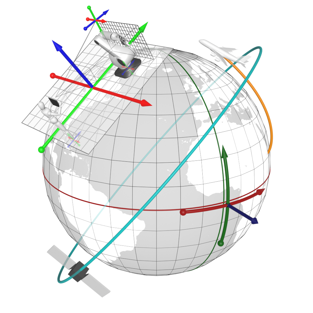
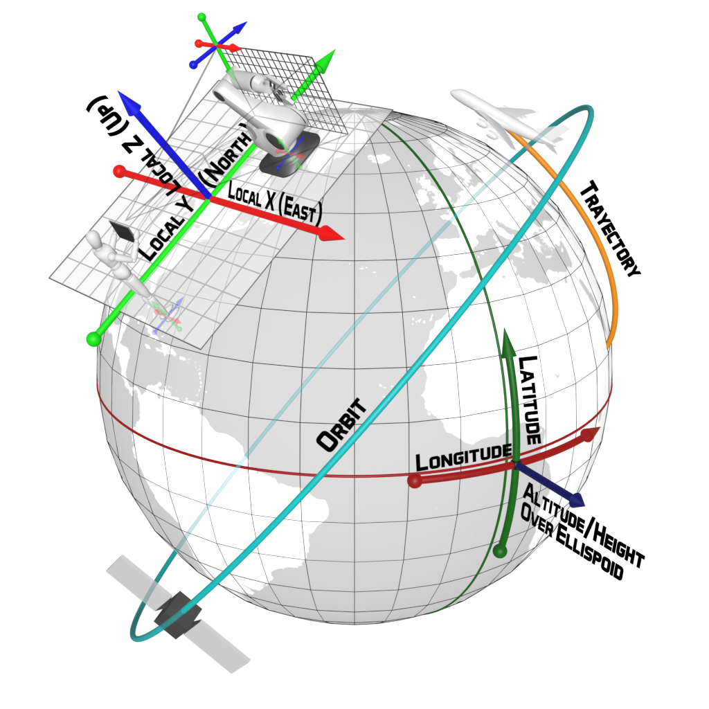
When a real or digital object's pose is defined relative to a geographical frame of reference, it will be called a geographically-anchored pose, or ''GeoPose'' for short. All physical world objects have a geographically-anchored pose. Digital objects may be assigned/attributed a GeoPose.
Why standardize GeoPose?
OGC GeoPose Standard defines the encodings for the real world position and orientation of a real or a digital object in a machine-readable form.
Using GeoPose enables the easy integration of digital elements on and in relation to the surface of the planet.

Augmented Reality
Geospatial AR experiences can use a common reference frame to position synthetic objects realistically within users the physical environment.

Autonomous Vehicles
The possibility of relating the autonomous vehicle to elements in its environment via a common reference frame is essential for decision making systems.

Built Environment
A common reference frame facilitates the integration of information about built structures when their representations are supplied by different sources.

Synthetic Environments
Access to one or more common reference frames through a graph of frame transformations permits a coherent assembly of stationary and moving objects in an animated scene.

Image Understanding
When an image or sequence of images is segmented into 3D objects in semantic categories, a common reference frame permits determining or constraining their motion and/or geometry.
GeoPose SWG Contributors


Implementers